Top 10 Islands in China w. Google Earth links (I)
[image sources]: 1. qly | 2. fashi | 3. google earth | 4. kovis | 5. 字里乾坤
An island or isle is any piece of sub-continental land that is surrounded by water. An archipelago is a chain or cluster of islands that are formed tectonically. — wikipedia
China has 6536 islands that are over 500 square meters in area, contributing to a total land territory of over 72,800 square kilometers and a total island coastline of 14,217.8 km. 450 of these islands are inhabited. Most China’s islands are small islands, uninhabited, and lack of fresh water.
There are three big islands that are over 1000 square kilometers in area: the Island of Taiwan, Hainan Island, Chongming Island. China’s islands can be divided into three categories by formation: rock island (90%), alluvial island, and coral island. As to location, 60% of all islands are in East China Sea, while about 30% are in South China Sea, 10% are in Yellow & Bohai Sea.
Today I am going to show you the Top 10 Most Beautiful Islands in China. You can view all first half of Top 10 Islands in China in Google Earth here.
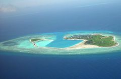
1. Xisha (Paracel) Islands 西沙群岛 – Colorful corals decorate China’s territory
Google Earth | Wiki | location: South China Sea
Xisha Islands (aka, Paracel Islands) is one of the four major archipelagos in the South China Sea. It has 22 islets, 7 sandbanks and 10+ reefs. This group of small and big islands floats on the sea of 30,000 square kilometers, purely and beautifully.
Among all South China Sea archipelagos, Xisha Islands has the most number of islets, the largest island in area (Yongxing Island), the highest in altitude (Shi Islet), the only diagenetic cemented rock islands and the only non-biological-formed island (Gaojian Rock), and has the largest total land area (8+ square km).
Located in the middle of tropical belt, Xisha Islands has a tropical monsoon climate, hot and humid, but no extreme heat. It is one of the most vulnerable regions to typhoon. Subject to hot and humid climate, with abundant rainfall and frequent typhoons, the archipelago is surrounded by productive fishing grounds and potential oil and gas reserves.
2. Weizhou Island 涠洲岛 – An artwork carved by water and fire
Google Earth | Wiki | location: Gulf of Tonkin
Weizhou Island is a island located to the south of Beihai City, Guangxi Province in Gulf of Tonkin. It is the largest and youngest volcanic island. It has costal erosion, deposition, and lava etc. marine landscapes, particularly the sea volcanic bay in the south part is very unique.
Weizhou Island was opened in 1994 as a provincial tourist resort and later as a National Geological Park. It integrates erupted volcanic deposition and coral sediment accumulation, so that the high and steep southern island shows an odd sharp contrast against the open and flat northern part.
3. Nansha Islands 南沙群岛 – The boundary marker built by corals for China
Google Earth | Wiki | location: South China Sea
Nansha Islands are the most southern located, the most in number, and the most scattered islands among four major archipelagos in the South China Sea. They are all coral islands. Nasha Islands and adjacent region is China’s only one located in core distribution area of coral reefs. Its beauty and richness is enough to emulate Maldives and Australia’s Great Barrier Reef and it’s larger than both of them.
Nansha Islands are rich in amphibian species and various aquatic products. It is China’s largest tropical marine fishery. Besides, it has vast deposits of mineral resources, such as oil and natural gas, iron, copper, manganese, phosphorus and other. It is particularly rich in oil and gas resources, with a geological reserve of about 35 billion tons, known as the “second Persian Gulf”.
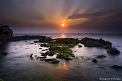
4. Penghu Islands 澎湖列岛 – Humanity and nature enhance each other’s beauty
Google Earth | Wiki | location: Taiwan Strait
Penghu Islands are located between mainland China and Taiwan. With this innate superiority of the special geographical conditions and a great harbor, since ancient times, it has become a vital military hub and important relay station for immigrants. It is the first developed area in Taiwan, the “key to the Taiwan Strait”.
Penghu Islands, not only has traditional villages of early immigrants, special spatial landscape adapted to the environment during the development, but also unique spatial landscapes of foreign colonial rule and military defenses. Various space landscape presents Penghu long and rich history of culture. These various spatial landscapes represent the long history and rich cultural characteristics of Penghu Islands.
5. Nanji Islands 南麂岛 – A wonderful marine biological park
Google Earth | Wiki | location: East China Sea
Nanji Islands are rich in marine resources, there are 403 kinds of shellfish, 174 kinds of algae, 397 kinds of fish, known as a “kingdom of shellfish & algae”. It is China’s only shellfish and algae national marine nature reserve and is designated as one of UNESCO World Biosphere Reserve.
Its Dashadai Beach is 800 meters long and 600 meters wide, and seawater is clear and transparent with a visibility of 5+ meters. It is a nationwide famous big beach, the best in Zhejiang Province. Other major attractions include Sanpanwei Natural Murals, 63 mo of fairy world-like evergreen natural grassland, a daffodil island, and several historical sites.
[Scenic Splendor of China Series]
This is one post of the Scenic Splendor of China Series. In 2005.10, Chinese National Geography (CNG) selected 114 “most beautiful places” covering 17 different types of scenic patterns. The complete list is here. In Chinese. These scenic places will be covered individually in future.
[Chinese Keywords]
中国最美的地方 海岛


